Mapping bathymetry and shallow water benthic habitats in inland and coastal waters with Sentinel-2
Accepted: 20 February 2023
HTML: 74
All claims expressed in this article are solely those of the authors and do not necessarily represent those of their affiliated organizations, or those of the publisher, the editors and the reviewers. Any product that may be evaluated in this article or claim that may be made by its manufacturer is not guaranteed or endorsed by the publisher.
Authors
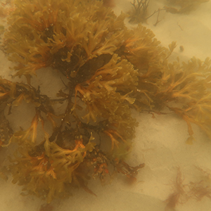
Accurate determination of the water depth and benthic macroalgae composition in coastal and inland water bodies is important due to the high commercial and ecological value of these regions. Benthic habitat mapping by conventional methods provides good accuracy, but these methods are very expensive and limited by manpower and time factor, which is necessary for mapping large areas. Remote sensing methods significantly complement contact measurements and give additional information about the hard-to-reach areas. The usefulness of free Sentinel-2 data in bathymetry and habitat mapping has been demonstrated in clear oceanic waters. The aim of this study was to further test the suitability of Sentinel-2 imagery in creating maps of dominant benthic types, as well as in estimating bathymetry in optically complex marine and lake waters. Two study sites were selected to cover a representative range of optical variability - Lake Garda in northern Italy (an intermediate between clear ocean and optically very complex waters) and Viimsi peninsula on the Estonian side of the Gulf of Finland, in the Baltic Sea. The results show that Sentinel-2 imagery with 10 m spatial resolution is suitable for bathymetry and habitat mapping in optically complex inland and coastal waters. Our results show that bathymetry mapping is sufficiently accurate in waters less than 4 m deep in the case of the Baltic Sea and up to 7 m deep in Lake Garda. In such depths, the R2 was above 0.93 in all four Sentinel-2 images used in the study. Bottom type mapping accuracy was in all cases over 73%, which is considered to be good, but due to the limited number of sampling points in both test sites, further studies are needed. The Sentinel-2 data quality and no cost of the imagery for users make it very useful for mapping bathymetry and shallow water habitats over large coastal areas or high number of lakes, especially in hard to reach by in situ methods areas. Moreover, the frequent revisit time allows moving from one-off maps to monitoring of temporal changes happening in dynamic shallow inland and coastal waters.


Edited by
Andrea Lami, CNR-IRSA Verbania, ItalySupporting Agencies
European Space Agency, Estonian Research CouncilHow to Cite

This work is licensed under a Creative Commons Attribution-NonCommercial 4.0 International License.
Similar Articles
- Bradley J. Austin, Violet Eagle, Michelle A. Evans-White, J. Thad Scott, Brian E. Haggard, Sediment phosphorus release sustains nuisance periphyton growth when nitrogen is not limiting , Journal of Limnology: Vol. 79 No. 3 (2020)
- Tânia C. dos Santos Ferreira, Marlene S. Arcifa, Experiments on invertebrate predation on cladocerans and its relationships with lake data , Journal of Limnology: Vol. 81 (2022)
- Antonella CATTANEO, Michèle DE SÈVE, Giuseppe MORABITO, Rosario MOSELLO, Gabriele TARTARI, Periphyton changes over 20 years of chemical recovery of Lake Orta, Italy: differential response to perturbation of littoral and pelagic communities , Journal of Limnology: Vol. 70 No. 2 (2011)
- Jochen VANDEKERKHOVE, Steven DECLERCK, Maarten VANHOVE, Luc BRENDONCK, Erik JEPPESEN, José Maria CONDE PORCUNA, Luc DE MEESTER, Use of ephippial morphology to assess richness of anomopods: potentials and pitfalls , Journal of Limnology: Vol. 63 No. s1 (2004): Diapause In Aquatic Invertebrates
You may also start an advanced similarity search for this article.
